Auto-route
Routes can be created automatically from your vessel’s location to a selected point on the chart.
Auto-route
Note
Auto-route requires compatible cartography and minimum safe distance settings to be configured.
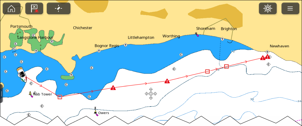
Figure 1. Example auto-route
Auto-routes are generated using cartography data and validated against the minimum safe distances configured in the Boat details menu: ().
Waypoints will not be placed in areas that conflict with your minimum safe distances. Caution symbols are used for waypoints that are near objects or restricted areas.
Important
ALWAYS check that each route leg is safe before initiating a route follow.