Predicted areas of danger
The Predicted areas of danger feature tracks Radar targets and AIS targets in relation to your own vessel’s Course Over Ground (COG) and Speed Over Ground (SOG).
Collision avoidancePredicted Area of Danger zoneIf your paths are predicted to cross, an Interception line is displayed between your vessel and the target. Additionally, Interception zones are displayed to indicate where there is an increased risk of collision. The Interception line and the Interception zones are based on your current course and speed and the target’s current course and speed, and they can help you determine whether you should change course and / or speed to avoid a potential collision.
The graphics automatically refresh when the MFD receives new position data from the target.
IRPCS / COLREGSThe Collision Avoidance feature is a graphical aid only, provided to help increase user awareness of the potential for collision. It is vital to have a good understanding of the International Regulations for Preventing Collisions at Sea (IRPCS / COLREGS), to ensure all actions taken are in accordance with the IRPCS. Important concepts to understand in relation to Collision Avoidance include (but are not limited to): Risk assessment; Right of Way; Restricted visibility; interpreting lights and shapes; interpreting sound and light signals. In the event of conflict, the IRPCS regulations must take precedence. For more information on IRPCS / COLREGS, refer to: IRPCS
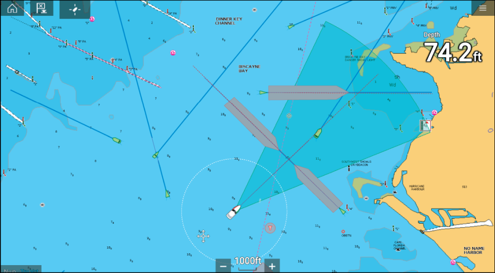
Moving target graphics
Collision avoidanceMoving targetMoving target graphics are used for targets moving at a speed greater than 2 kts.
Interception zone (Predicted area based on target’s last reported position)
Interception line
Target COG line
AIS Target (Last received position)
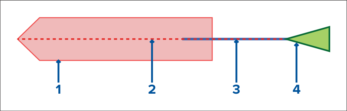
Stationary Target graphics
Collision avoidanceStationary targetStationary target graphics are used for targets moving at a speed less than 2 kts.
Interception zone (Predicted area based on target’s last reported position)
Stationary AIS Target (Last received position)
You must still maintain a permanent watch for:
Vessels that are not equipped with AIS or AIS-equipped vessels that are not currently transmitting their position, as these targets will not be displayed in the Chart application.
AIS-equipped vessels reporting an inaccurate GPS position, your own vessel’s GPS accuracy, or AIS targets with delayed location updates. These situations will cause your vessel’s position and / or AIS target positions to be displayed inaccurately in the Chart application.
Objects not detected by your Radar scanner.