Radar target context menu
When an acquired Radar target is selected in the Chart app, the Radar target context menu is displayed.
Radar targetContext menuThe Radar target context menu includes the following information and settings:
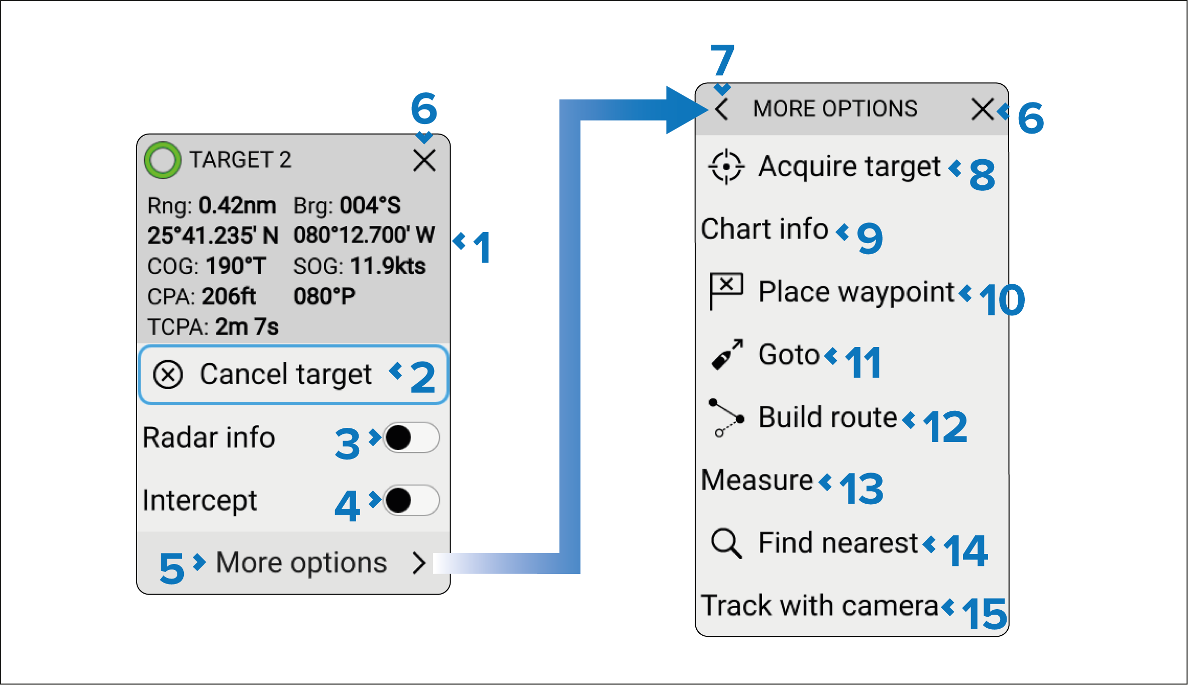
Target data — The following data is displayed:
Rng (Range).
Brg (Bearing).
Latitude and Longitude.
COG (Course Over Ground).
SOG (Speed Over Ground).
CPA (Closest Point of Approach).
TCPA (Time to Closest Point of Approach).
Cancel target — Delete the selected Radar target.
Radar info — Enable and disable onscreen display of data next to the target symbol.
Intercept — Enable and disable target interception.
More options — View further options.
X (close)
— Close the context menu.< (Back arrow) — Go back to previous context menu.
Acquire target — Acquire the AIS target as a Radar target.
Chart info — View details of any nearby objects.
Place waypoint — Create a new waypoint at the target’s current location.
Goto — Perform a goto.
Build route — Create a route.
Measure — Use or remove the ruler tool.
Find nearest — Search for nearby point of interest.
Track with camera — Track the target with a compatible PTZ (Pan Tilt Zoom) camera.
First responder
When the MFD/chartplotter is configured using the First Responder activity, the following additional data and options will be available:
AIS data — Boat type, Status, Intcpt (Intercept time).
Designate TOI.
Send message.