Tides mode
Tides mode suppresses chart detail to enhance tide and / or current information and provides set and drift vectors for your vessel. Tide mode also displays an animation progress bar. Depending on the cartography in use, tide and / or current station symbols may be replaced with dynamic graphics. Dynamic graphics can be animated using the Animate tides option which enables playback of tide and / or current predictions for a 24 hour period.
Set and drift vectors require a paddle wheel transducer.
Animations are only available on supported cartography. Refer to your cartography provider for more information.
Tides mode requires accurate date information, taken from your GNSS / GPS position data. Alternatively, you can input a specific date manually.
ChartTides mode
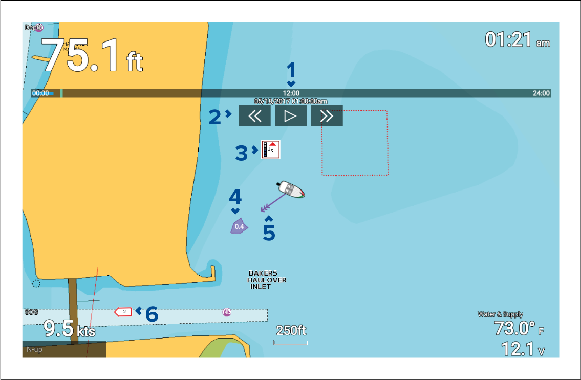
Animation progress bar — The bar fills with Blue as the animation progresses for the current 24 hour period, or Green when playing animations from a different period.
Playback controls — Provides controls to play and stop animation playback or skip forwards or backwards through the animation.
Dynamic tide graphic — Available when using Navionics cartography.
Drift value — Provides drift value in specified speed units.
Set vector — Vector arrow identifies tide direction
Dynamic current graphic — Available when using Navionics cartography.
The data provided in the tide and current graphs and graphics is for information purposes only and must NOT be relied upon as a substitute for prudent navigation. Only official government charts and notices to mariners contain all the information needed for safe navigation.