Current station information
Depending on your cartography, Current station information may be available.
Current station symbol
ChartCurrent station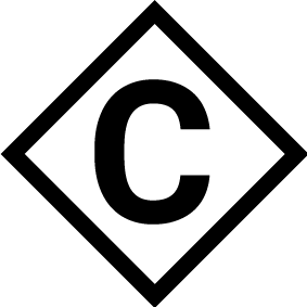 |
Current station locations are marked on the chart using a diamond-shaped symbol with a ‘C’ in the middle.
|
Dynamic current graphic
ChartCurrent graphicUsing Navionics cartography, when the Tides option is enabled (), the current station symbol is replaced with a dynamic current graphic:
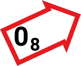 |
The dynamic current graphic is an arrow pointing in the direction of current flow. Arrow length indicates the speed of the current; the longer the arrow, the faster the speed. The arrow’s border indicates current status:
Current speed is shown inside the arrow. Current speed is displayed in user-selected speed units, with decimals displayed in subscript. Decimals are not shown for values of 10 or greater. If tidal conditions are “slack”, the word “SLACK” appears in a box with a Blue border. |
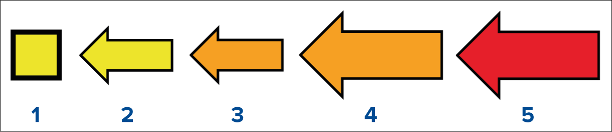
When using C-Map cartography, arrows are used to indicate the direction of current flow. The size and color of the arrow indicates the strength of the current:
Color |
Speed |
|
|---|---|---|
| 1 | Yellow |
0 to 0.1 Knots |
| 2 | Yellow |
0.2 to 1.0 Knots |
| 3 | Orange |
1.1 to 2.0 Knots |
| 4 | Orange |
2.1 to 3.0 Knots |
| 5 | Red |
>3.0 Knots |
Current graph
ChartCurrent graphCurrent graphs are available by selecting more options and then Current station from the current station’s context menu.
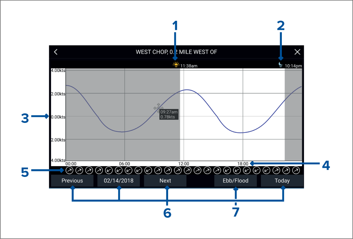
Sunrise — Indicates time of sunrise.
Sunset — Indicates time of sunset.
Speed — Provides current speed in selected units.
Time — Indicates time of day.
Direction — Indicates the direction of the current (relative to North).
Time and date options — Use the buttons to view previous, next or today’s tide predictions, or enter a date by selecting the date field.
Ebb / Flood — Displays a list showing ebb, slack and flood tides.