Radar app overview
Radio Detection and Ranging (RADAR) is used on the water to detect the presence of objects at a distance, and if they are moving, detect their speed. Radar works by transmitting radio pulses, then detecting reflections of these pulses (echoes) from objects in the area. The Radar app is a navigation aid, used to enhance situational awareness by displaying a visualization of the echoes received by a connected radar scanner.
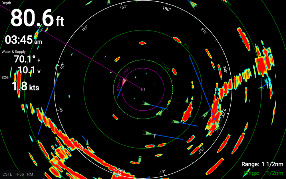
Radar appThe Radar app can be displayed in Fullscreen and splitscreen app pages.
For details on how to interpret the radar display refer to: Interpreting the Radar display
Some features of the Radar app require your display to have both a GNSS (GPS) position fix and compass heading data available, e.g.: to enable accurate display of AIS targets in relation to your vessel and to report geographical positions (Latitude and Longitude) of the cursor position.
Radar target tracking and Doppler features are not available in LightHouse™ Sport.
Radar appGuard zoneThe Radar app allows you to configure a Guard Zone alarm which is triggered when an object is located within the specified guard zone area.
Radar appVRM/EBLThe Range rings, the bearing ring and a VRM/EBL can be used to identify a target’s range and bearing in relation to your vessel.
AIS targets can also be displayed and tracked in the Radar app.