Depth soundings
Water depth measurements displayed on charts are called Depth soundings.
Usually Depth soundings are shown using major and minor units, with minor units being smaller and subscript e.g.: Depending on units of measure ‘15’ would mean 1.5 metres, 1 Fathom and 5 feet or 1.5 feet.
Raster charts
Depth soundingsUnitsOn Raster charts the units of measure the used for Depth soundings is fixed. The display of Depth soundings is also fixed and will only change depending on Chart app range scale.
Vector charts
Depth soundingsUnitsOn Vector charts Depth soundings will use the units of measure specified for depth in the MFD’s settings: .
Depth sounding values appear differently onscreen:
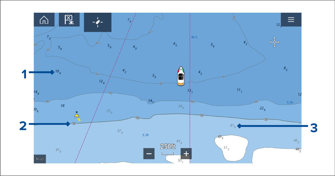
Figure 1. Example LightHouse™ Charts Depth soundings
Bold depth soundings — Depth soundings displayed in Bold reflect depths shallower than the specified Safety contour depth.
White outlined depth soundings — Depth soundings displayed with a white (‘Halo’) outline reflect depths that are the same as the Safety contour depth.
Gray depth soundings — Depth soundings displayed in Gray reflect depths deeper than the specified Safety contour depth.
Depth soundingsOptionsOn Vector charts Depth soundings can be customized from the Depths settings menu:
The following Depth soundings options are available:
None — No Depth soundings are displayed unless they are linked to a depth contour.
Manual — Depth soundings are only shown from zero to the depth specified in the Zero to: option.
All — All Depth soundings are displayed.
When Show soundings is set to All all depth soundings will be displayed.