Cloud top and Lightning layers
The cloud top layer provides a satellite image of current cloud coverage and the lightning layer provides symbols to show the location of recent lightning strikes.
Weather mode Cloud tops layerLightning layer
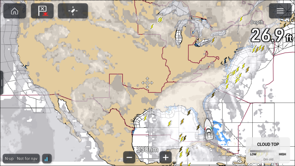
Cloud tops
Cloud tops use Gray shading to identify cloud top height. The shading changes at 5,000 feet increments, from Dark Gray to White. Clouds lower than 5,000 feet are not displayed. A legend is available that can be displayed onscreen to aid identification of cloud top heights.
The legend can be enabled from the main menu: .
The cloud tops layer can be enabled and disabled from the Weather layers menu: .
Lightning
The shade of the lightning symbols represent the time the lightning strike was detected.
 |
 |
 |
0 to 5 minutes ago |
5 to 10 minutes ago |
10 to 15 minutes ago |
The lightning layer can be enabled and disabled from the Weather layers menu: .