Nautical measured mile markers
CalibrationSpeedSpeed calibrationMeasured mileMile markersEach marker in a pair is separated by distance and elevation from its partner. The front marker is closer to the water and shorter than the marker behind it.
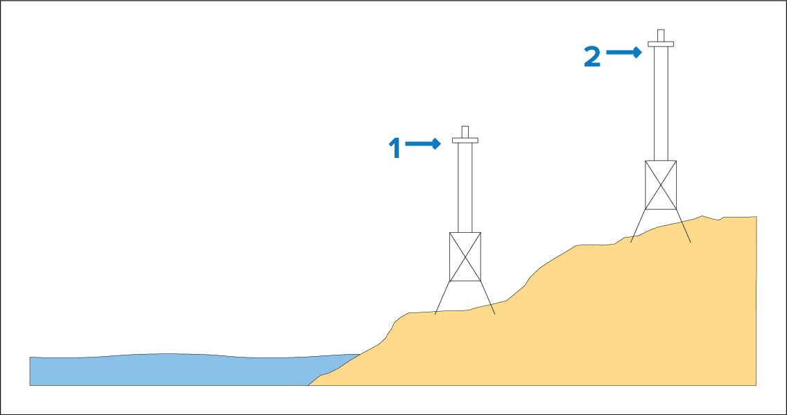
Figure 1. Markers — side view
Front marker
Rear marker
When the 2 markers appear vertically aligned your vessel is on the correct range line to begin a measured mile run.
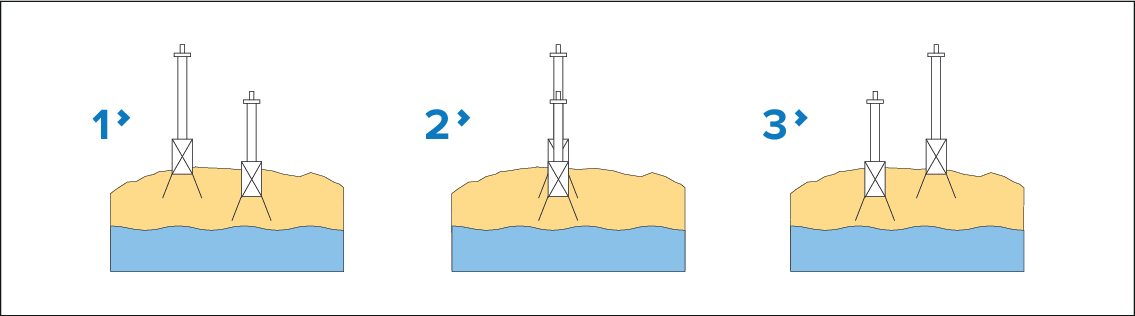
Figure 2. Marker alignment (viewed from vessel)
Vessel left of range line
Vessel on range line
Vessel right of range line
CalibrationSpeedThe vessel should already be at top speed and as the first pair of markers appear aligned a stopwatch should be started, when the vessel passes the second pair of aligned markers the stopwatch is stopped.
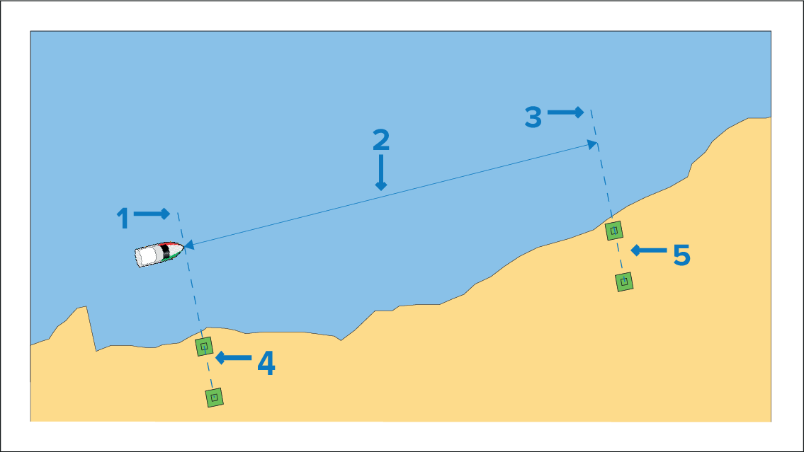
Figure 3. Measuring a nautical mile
Starting point (start stopwatch)
Measured mile
End point (stop stopwatch)
First pair of markers
Second pair of markers
To provide a more accurate reading the vessel should make between 4 to 6 runs in both directions to allow for tide and wind conditions. The average of the time taken over all runs should be used to calculate Log Speed.
The Log speed can then be worked out by taking the distance travelled (1 nautical mile) and dividing it by the average time taken to perform the run . The resulting calculation is your average speed in knots.