RealVision™ 3D overview
CHIRPRealVision™ 3D 3D Vision
3D Vision provides a true, easy-to-understand view of bottom topography, debris, and fish.
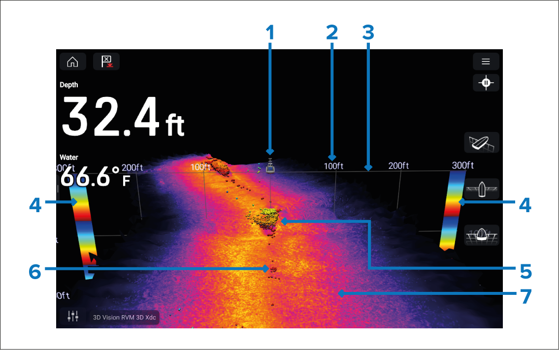
Figure 1. 3D Vision screen interpretation
Vessel location — The vessel icon indicates the location and direction of your vessel.
Range scale — The range scale indicates distance (range) to port and starboard from your vessel.
Water line — This line represents the top of the water column.
Depth indicator — Provides an indication of object depths.
Structure — Example of bottom structure, including underwater structures such as pipelines, piers, and other large solid structures.
Sonar returns — Sonar return / detected object.
Bottom — Solid mass indicating the bottom. It may be possible to identify the transition of bottom material (e.g.: where an area of mud meets an area of gravel).