System example
The system example below shows devices that can be connected in conjunction with the Smart Wind transducer to a multifunction display / chartplotter in order to display and calculate accurate wind data.
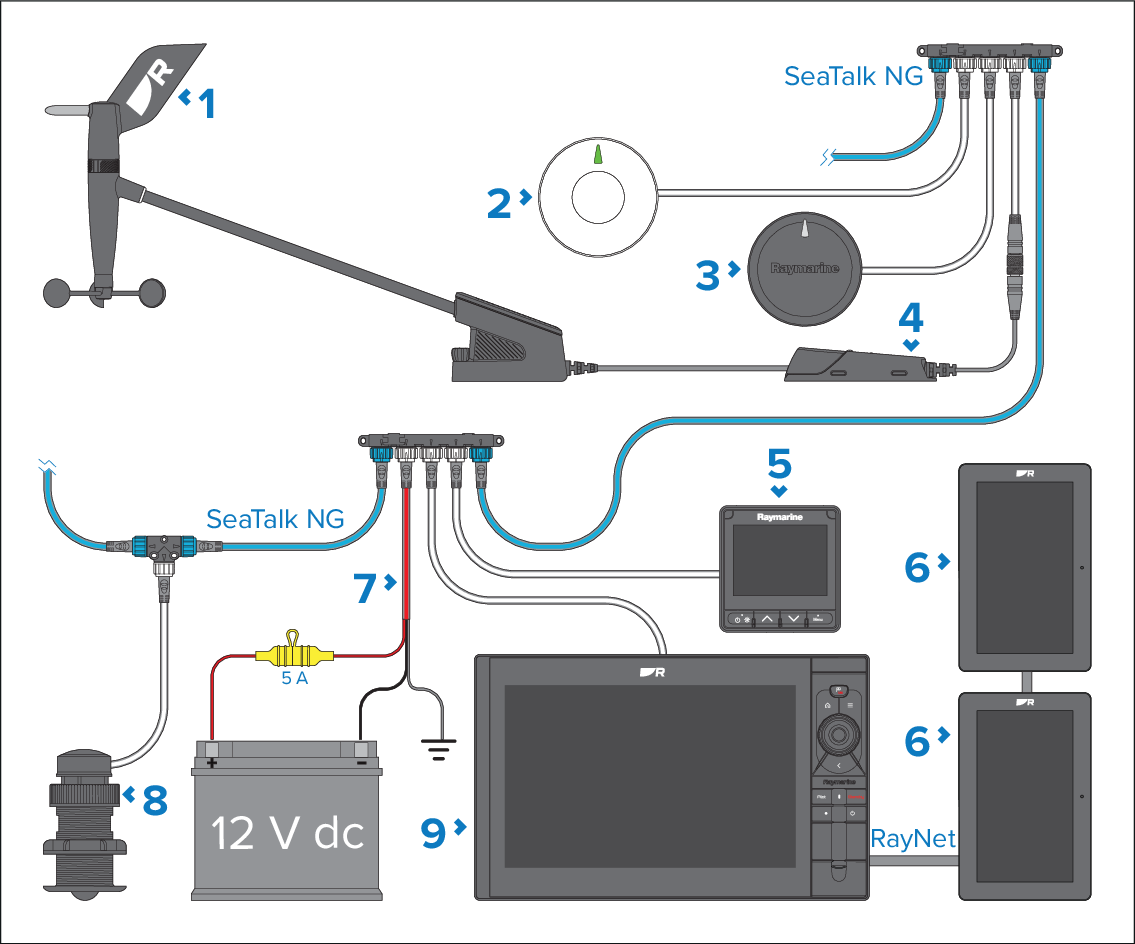
RSW-Wired Smart Wind transducer.
GNSS (GPS) receiver (e.g.: RS150).
Heading sensor (e.g.: EV-SeriesEV-1).
NMEA 2000 gateway (supplied).
i70s instrument display, running software version v3.22 or later.
Alpha series displays.
SeaTalk NG 12 V dc power connection.
Speed transducer (e.g.: DST800).
MFD / charplotter (e.g.: Axiom 2 Pro), running LightHouse 4, v4.6.103 or later.
In order for your connected multifunction display / chartplotter to calculate and display True wind values, Speed Through Water (STW) (received from a speed transducer) and Heading (received from a heading sensor) data must be available on the network.
In order for your connected multifunction display / chartplotter to calculate and display Ground wind values, a GNSS (GPS) receiver is required.
For more information on the available speed transducers and heading sensors, refer to: Spares and accessories